Books & Magazines

Discover the Northern Plains of India, their fertile lands, vast rivers, and role in India's agriculture. Learn why the Northern Plains of India are vital!
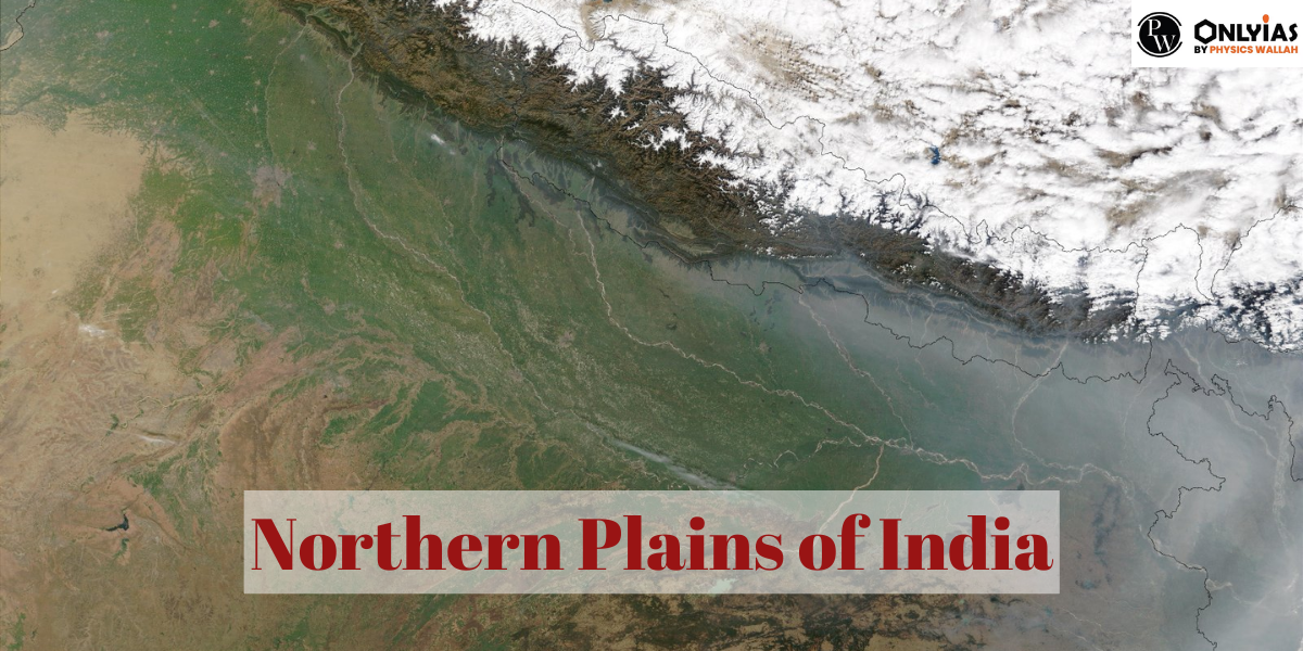
Northern Plains of India, following the Indian desert, constitute the second-youngest physiographic region in the country. Bounded by the Shiwalik range to the north, the Desert to the west, the Peninsular Plateau to the south, and the Puruvachal Hills to the east, these plains are shaped by the alluvial deposits of the Indus, Ganga, and Brahmaputra river systems along with their tributaries.
Extending approximately 2400 km from west to east and 150–320 km from north to south, the Northern Plains cover an expansive area of over 7 lakh square kilometres. Fed by the abundant waters of the mentioned rivers, these plains boast a favourable climate and fertile alluvial soil, supporting a dense population.
The gentle slope of the rivers in this region facilitates a slow flow of water. Ambala, situated in the state of Haryana, marks the highest elevation at 291 meters above sea level, acting as a watershed between the Ganga and Indus river systems.
The Northern Plains extend approximately 2,400 km from west to east and 150-320 km from north to south. The ample water supply, favourable climate, and fertile alluvial soil contribute to the high population density in the northern plains.
Situated between the Yamuna catchment in the west and the Bangladesh border in the east, the Ganga plains encompass a region that extends from the Rajmahal hills to the Meghalaya plateau. This expansive area, formed by the downwarping of a portion of Peninsular India, is sculpted by the sedimentation of the Ganga and Brahmaputra rivers.
Also Read:
Key topographical features of the Ganga plains include levees, abandoned golf courses, and distinct regions such as Bhabar, Tarai, Bhangar, and Khadar plains. The continuous shifting of river courses renders the region prone to periodic floods, with the Kosi River earning the moniker “Sorrow of Bihar.” This fertile expanse is home to the northern states of Haryana, Delhi, Uttar Pradesh, Bihar, a part of Jharkhand, and West Bengal.
The Ganga-Brahmaputra delta, the largest delta globally, includes the tidal woods of the Sunderbans, housing the world’s largest mangrove swamp. The delta’s unique ecosystem supports diverse wildlife, including crocodiles and the Royal Tiger.
Also Read:
Situated on the upper Ganges alluvial plain in northwest Uttar Pradesh, Rohilkhand is a low-lying alluvial tract nestled between the Avadh Plain and the Ganga River. Historically known as Madhyadesh, it derives its name from the Rohilla tribe, with Pathan highlanders of the Yusufzai tribe, known as Rohillas, dominating the area.
Located in the heart of Uttar Pradesh, between Purvanchal in the east and Rohilkhand in the west, Awadh Plain, formerly hailed as India’s granary, is renowned for its distinctive cultures and cuisines, encompassing cities like Kanpur, Rae Bareli, and Faizabad.
Bounded by the Chota Nagpur Plateau to the west and the ever-changing Ganges River’s main flow to the east, the Rarh region constitutes the lower Gangetic plains. Formed by ancient alluvial deposits, this area is characterized by the Damodar River, industrialization, and a history marked by severe floods.
The Chhattisgarh plain, unique within the peninsular plateau, resembles a saucer-shaped dip drained by the upper Mahanadi. Bordered by the Chota Nagpur plateau to the north, Raipur Upland to the east, Bastar plateau to the southeast, and the Maikala Range to the west, it is known for its rich coal reserves and abundant natural resources.
The northern part of the Indian land became a big bowl because of the rise of the range in the Tethys Ocean. This bowl was filled with sediments carried by rivers from the mountains in the north and the peninsula in the south. These extensive deposits led to the formation of the northern plains of India. The physiographic divisions of the northern plains are:
In the west of the Aravalis, you’ll find the Marusthali and Rajasthan Bagar regions. These areas have brackish lakes formed when the land sank and seawater filled in. The Luni River is the only one that reaches the ocean, even though there are other rivers that don’t. This place is mostly covered with dunes and sand. The southern part of Bagar is more fertile, and it’s drained by the Luni River.
Physical features in this region are shaped by rivers like Satluj, Beas, and Ravi. The fertile lands between these rivers, called Doabs, are very productive. The northern part of the region has seen a lot of erosion because of small streams.
The northern portion of the Indian Peninsula sank, creating a basin due to the Himalayas’ uplift in the Tethys Sea. Sediments from rivers filling this basin, particularly from the south and north, resulted in vast alluvial deposits, forming the northern plains of India.
The Northern Plains of India, blessed with exceptionally fertile soil, stand as an agricultural haven. This region’s agricultural significance is underscored by the diverse array of crops thriving in its rich earth. Among the crops cultivated in these plains are maize, millets, jute, sugar cane, rice, and wheat, each benefiting from the nutrient-rich environment that characterizes the Northern Plains.
The fertility of the soil in this area not only supports robust agricultural activities but also plays a pivotal role in human settlement. The Northern Plains boast a combination of fertile soil, abundant rivers, and a congenial climate, making them ideal for habitation and cultivation alike. The intricate interplay of these elements has contributed to the establishment of a flourishing agricultural community.
Moreover, the Northern Plains have witnessed the construction of numerous dams, strategically built for multifaceted purposes. These dams serve as vital reservoirs, ensuring a consistent water supply for irrigation, a cornerstone of the region’s agricultural success. Simultaneously, they harness the power of flowing rivers to generate electricity, addressing both agricultural and industrial needs.
The fertile soil, abundant rivers, and favorable climate make the Northern Plains suitable for human settlement. Dams support various purposes, including irrigation and electricity production. Socially and religiously significant, these plains facilitate trade and commerce through navigable rivers.
People in the Northern Plains of India express their culture and art in different ways like writing, beautiful artworks, and building designs. The history and geography of the region inspire them to create things that show what life is like in these fertile lands.
Also, the rivers that flow through the Northern Plains are like natural highways. They make it easy for people to trade and do business. This has been happening for a long time and has helped the region grow economically. The rivers act as important trade routes, connecting different towns and encouraging business, making the Northern Plains a prosperous area.
To put it simply, the Northern Plains of India are not just important for farming. They are a lively and varied region. The good soil, the friendly weather, and the rivers working together don’t just support farming; they also shape how people live, connect with each other, and make a living in this fertile place.
Bhabar is a narrow, porous strip located in the northernmost part of the Great Plains, approximately 8-16 kilometers wide. It runs east-west along the foothills of the Shivaliks, formed by the deposition of alluvial fans from rivers descending from the Himalayas. The porosity of Bhabar, caused by the accumulation of pebbles and rock debris, leads to dry river courses outside the rainy season. The Bhabar belt is narrow in the east but widens in the west and northwest hilly regions, characterized by giant trees with large roots, making it unsuitable for cultivation.
South of the Bhabar belt lies the Terai, a poorly drained, wet, and densely forested narrow track running parallel to Bhabar. It stretches approximately 15-30 kilometers and is fed by subsurface streams from the Bhabar region. The Terai is a highly forested area, home to a diverse assortment of animals. Kaziranga National Park in Assam and Jim Corbett National Park in Uttarakhand are part of the Terai. The eastern parts of the Terai receive more precipitation than the western parts, making it more evident in the east. Much of the Terai terrain, especially in Punjab, Uttar Pradesh, and Uttarakhand, has been converted to agricultural land, yielding good crops such as sugarcane, rice, and wheat.
The southern reaches of the Terai belt are defined by new and old alluvium deposits, known as Bhanger and Khadar. These plains exhibit features like sandbars, meanders, oxbow lakes, and braided channels, typical of mature fluvial erosional and depositional features. The riverine islands and sandbars of the Indus-Ganga-Brahmaputra plains are well-known, with floods and fluctuating river patterns being common in these areas.
These features collectively define the Northern Plains of India, which, aside from these distinctive characteristics, are generally featureless, rising barely 100-150 meters above sea level on average.

Stretching from Haryana, including Delhi, Uttarakhand, and Uttar Pradesh, through parts of Rajasthan, Madhya Pradesh, Bihar, and Jharkhand to West Bengal, these plains cover a total distance of around 3200 kilometers from west to east. Recognized as one of the most fertile regions in India, these plains play a crucial role in the country's agricultural landscape.
The northern coastal plains of India refer to the stretch of flat land along the northern coastline, primarily in the states of Gujarat, Maharashtra, and Goa. These plains are characterized by fertile soil and are important for agriculture and port cities.
The term "Northern Plains" in India typically refers to a vast region that spans across multiple states in the northern part of the country. It includes states such as Haryana, Punjab, Delhi, Uttar Pradesh, Bihar, parts of Rajasthan, and portions of Jharkhand and West Bengal. The Northern Plains are characterized by their flat topography and fertile alluvial soil, primarily formed by the deposits of major rivers like the Ganga, Brahmaputra, and their tributaries.
The Northern Plains of India are renowned for their extraordinary fertility, making them a major agricultural hub. These plains, formed by the alluvial deposits of rivers like the Ganga and Brahmaputra, are home to significant cities, historical sites, and dense populations. They play a crucial role in India's agriculture, economy, and cultural heritage.
The Northern Plains of India include several states, and there isn't a strict categorization of four specific states as the "northern plains." However, the states commonly associated with the Northern Plains due to their flat topography and fertile soil include: Uttar Pradesh: The largest state in India by population, it is a significant part of the Northern Plains. Haryana: Known for its agricultural productivity and proximity to Delhi, Haryana is part of the Northern Plains. Punjab: Famed for its fertile land and a major contributor to India's agricultural output, Punjab is part of the Northwestern plains. Delhi: While technically a Union Territory with its own governance, Delhi is geographically situated in the Northern Plains and is an important urban center.
To the north of the northern plains of India lies the Himalayan mountain range. The northern plains are bordered by the Himalayas to the north and are a vast expanse of fertile land formed by the rivers of the region.
The length of the northern plains of India spans approximately 2,400 kilometers, extending from the western part of the country in Gujarat to the eastern part in Assam.


Connect with our experts to get free counselling & start preparing
Books & Magazines 
Prelims Wallah (Q&A Bank)
Udaan
Udaan 500+
Budget & Economic Survey
Monthly Current Wallah
Weekly Current Wallah
Editorial Summary
Editorial Q&A Compilation
NCERT Wallah
Prahaar (Mains Wallah)
Marks Booster
Mains Wallah (Q&A Bank)


<div class="new-fform">
</div>
 GS Foundation
 Crash Course
 Combo
Combo Optional Courses
 Degree Program