
Books & Magazines

 25 Oct 2024

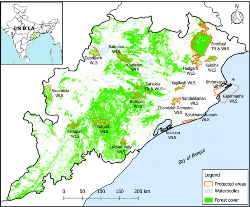
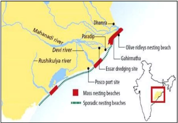
The severe cyclonic storm, packing wind speeds of up to 120 km per hour, was expected to make landfall close to Bhitarkanika National Park and Dhamra port in Odisha on 25th October.

| Mon | Tue | Wed | Thu | Fri | Sat | Sun |
|---|---|---|---|---|---|---|
| 1 | ||||||
| 2 | 3 | 4 | 5 | 6 | 7 | 8 |
| 9 | 10 | 11 | 12 | 13 | 14 | 15 |
| 16 | 17 | 18 | 19 | 20 | 21 | 22 |
| 23 | 24 | 25 | 26 | 27 | 28 | 29 |
| 30 | 31 | |||||


Connect with our experts to get free counselling & start preparing
Books & Magazines 
Prelims Wallah (Q&A Bank)
Udaan
Udaan 500+
Budget & Economic Survey
Monthly Current Wallah
Weekly Current Wallah
Editorial Summary
Editorial Q&A Compilation
NCERT Wallah
Prahaar (Mains Wallah)
Marks Booster
Mains Wallah (Q&A Bank)


<div class="new-fform">
</div>
 GS Foundation
 Crash Course
 Combo
Combo Optional Courses
 Degree Program