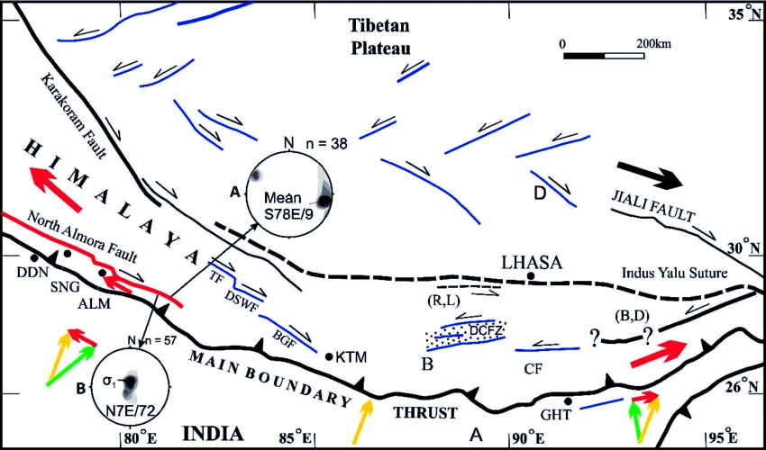
Context: Recently, the Union Minister of Earth Sciences has informed Lok Sabha that the earthquake activity in the year 2023 increased and it was mainly attributed to the activation of the Almora fault in Western Nepal.
- There have been 97 earthquakes in 2023 compared to 41 in 2022.
About Almora Fault
- Tectonic Plates Separating Lesser Himalayas: The Almora Fault is a high angle west-northwest-east-southeast to northwest-southeast trending tectonic plane.
- It separates the Garhwal group of inner lesser Himalayas in the north from Jaunsar and Dudhatoli Groups of outer lesser Himalayas in the south.

- Fault: It is a sharp break in the crustal rocks. Rocks along a fault tend to move in opposite directions. As the overlying rock strata press them, the friction locks them together.
- However, their tendency to move apart at some point of time overcomes the friction and the blocks get deformed and eventually, they slide past one another abruptly.
- This causes a release of energy, and the energy waves travel in all directions.
- Earthquake: It is a natural event, which is the shaking of the earth. It is caused due to release of energy, which generates waves that travel in all directions.
- Hypocentre: It is the point where the energy is released. It is also called as the focus of an earthquake.
- Epicentre: It is the point on the surface, nearest to the focus. It is a point directly above the focus and the first one to experience the waves.
Earthquakes in Northern India and Nepal
- A Common Phenomenon: It is common for northern India and Nepal to experience moderate earthquakes and fluctuations in seismic activity occasionally.
- Seismic Active Zones: Nepal and the neighboring northern part of India are situated near the active faults of the Himalayan region.
- These are highly seismically active areas prone to frequent earthquakes due to collision tectonics, where the Indian plate subducts beneath the Eurasian Plate.
Why the Himalayas are Prone to Earthquake?
- The Himalayas is a tectonically unstable region as it is the convergence zone of the Indian and Eurasian plates.
- The mountain building process is still going on because the Indian plate is still moving towards the Eurasian plate.
- The Indian plate is pushing the Asian plate northward at the rate of about 2 cm per year. This means that in every 100 years India moves 200 cm north against the Asian plate.
- This colliding force builds up pressure continually for several years and this pressure is released in the form of earthquakes from time to time.
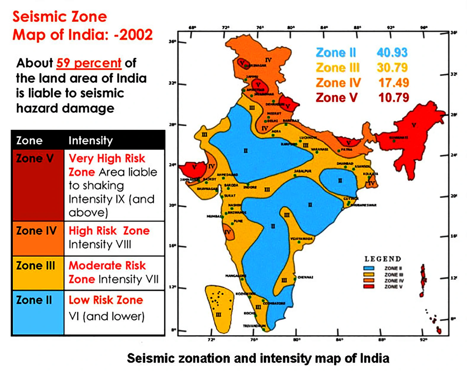
Seismic Zoning Map of India
- Published by: The Bureau of Indian Standards (BIS) published the Seismic Zoning Map of India, ranging from Zone II to V.

- Basis of Zones: The zones are divided on the basis of Modified Mercalli (MM) intensity, which measures the impact of earthquakes.
- BIS also offers guidelines for implementing the essential engineering codes and practices to construct earthquake-resistant buildings.
News Source: Livemint
![]() 8 Dec 2023
8 Dec 2023

