Books & Magazines

 26 Mar 2024
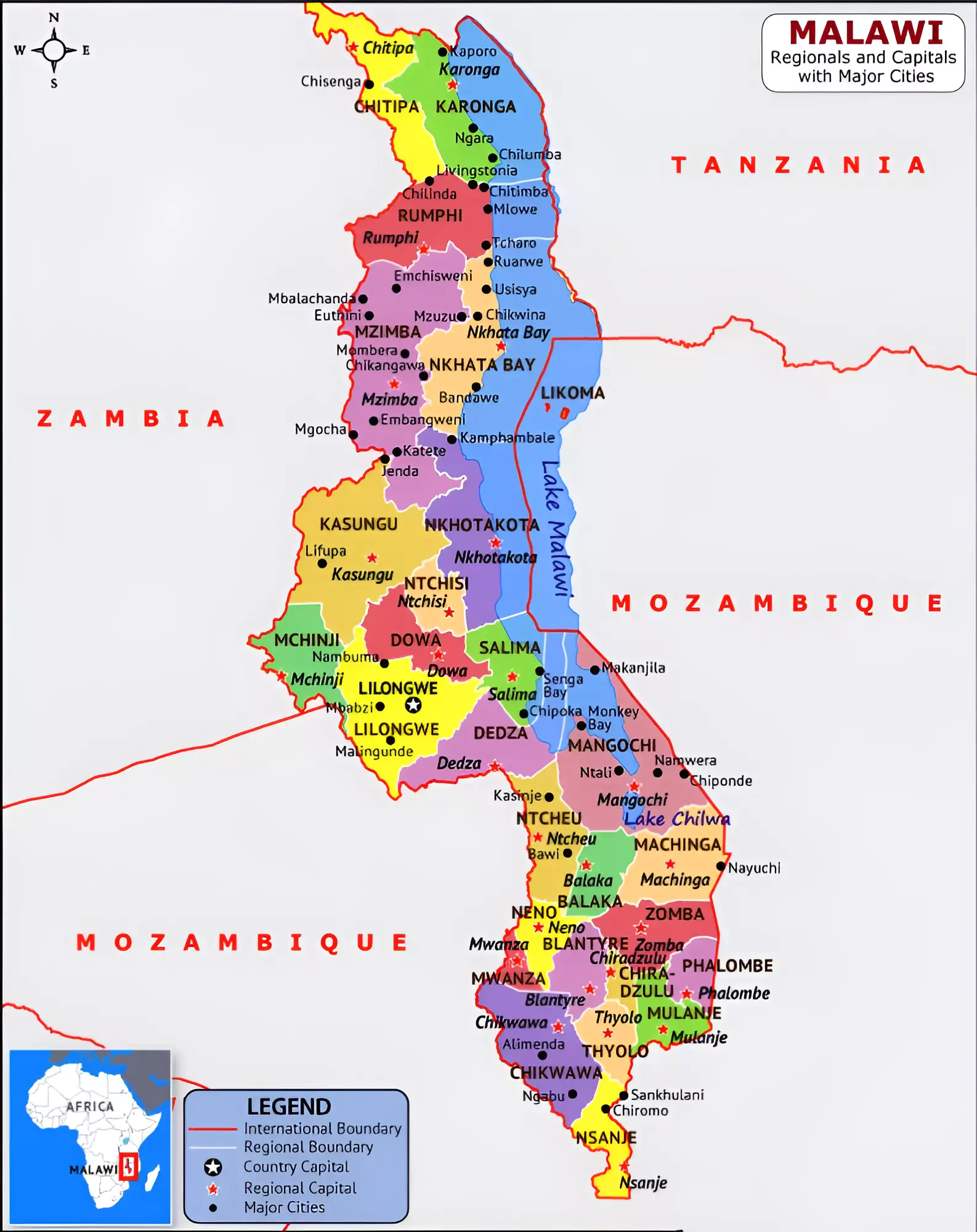
Malawi has declared a state of disaster in 23 out of its 28 districts due to severe drought.
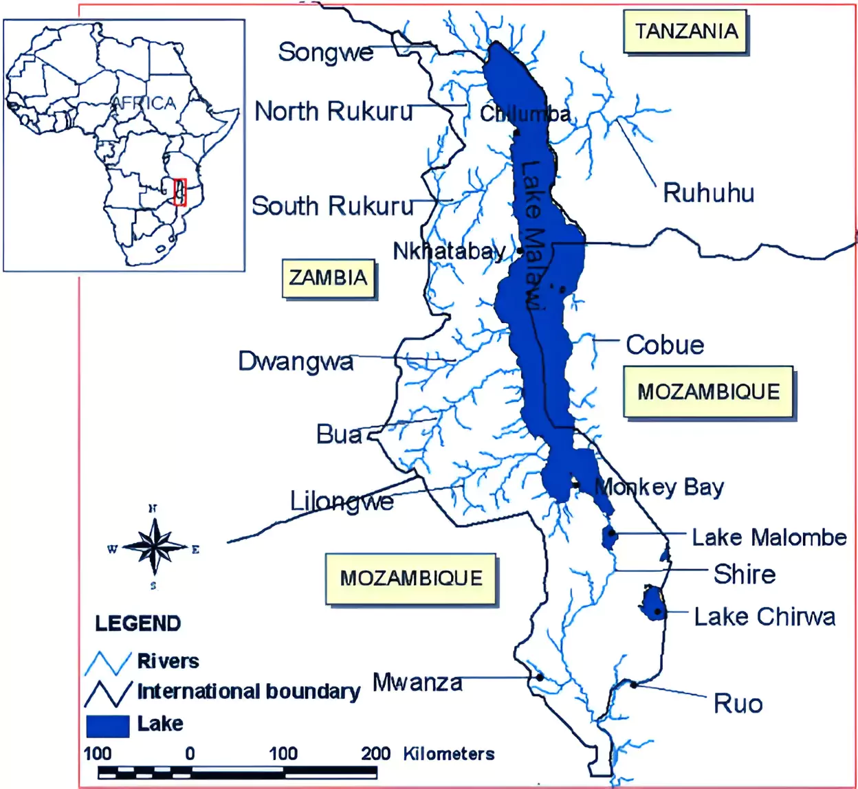 Highest peak: Sapitwa.
| Must Read | |
| NCERT Notes For UPSC | UPSC Daily Current Affairs |
| UPSC Blogs | UPSC Daily Editorials |
| Daily Current Affairs Quiz | Daily Main Answer Writing |
| UPSC Mains Previous Year Papers | UPSC Test Series 2024 |

| Mon | Tue | Wed | Thu | Fri | Sat | Sun |
|---|---|---|---|---|---|---|
| 1 | ||||||
| 2 | 3 | 4 | 5 | 6 | 7 | 8 |
| 9 | 10 | 11 | 12 | 13 | 14 | 15 |
| 16 | 17 | 18 | 19 | 20 | 21 | 22 |
| 23 | 24 | 25 | 26 | 27 | 28 | 29 |
| 30 | 31 | |||||


Connect with our experts to get free counselling & start preparing
Books & Magazines 
Prelims Wallah (Q&A Bank)
Udaan
Udaan 500+
Budget & Economic Survey
Monthly Current Wallah
Weekly Current Wallah
Editorial Summary
Editorial Q&A Compilation
NCERT Wallah
Prahaar (Mains Wallah)
Marks Booster
Mains Wallah (Q&A Bank)


<div class="new-fform">
</div>
 GS Foundation
 Crash Course
 Combo
Combo Optional Courses
 Degree Program