Context
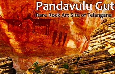
Pandavula Gutta was recently officially recognised as Telangana’s sole geo-heritage site.
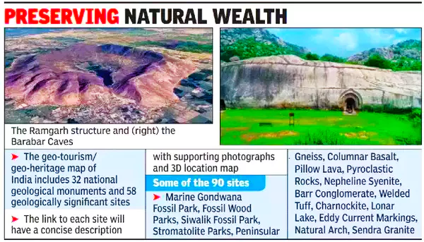
- Recently, the Rajasthan Government also designated Ramgarh Crater at Baran District as a Geoheritage site.
About Pandavula Gutta
- It is a geological marvel older than the Himalayan hills.
- Location: Jayashankar Bhupalpally district, Telangana.
- Discovery: First discovered in 1990.
- Features:
- Prehistoric Habitation: It exhibits many sites from mesolithic to medieval periods.
- Rock Art: Prehistoric man’s rock art was identified on walls and ceilings of caves, rock shelters and isolated boulders.
- Depictions of Wildlife: The rock art paintings depict wildlife like Bison, Antelope, Tiger, Leopard etc.
- Unique Blend of Natural Colors: impressions in green, red, yellow and white pigment colors.
- Geometrical Shapes & Design: Swastika Symbols, circles and squares, weapons depicted such as bows, arrows, swords and lancer etc, are present in these paintings.
- Major Attraction: Paleolithic Rock Art Paintings, Eduru Pandavula Guhalu, Rock Climbing, Rappelling and Hiking.
About Ramgarh Crater
- It is a terrestrial Meteorite Impact Crater
- Location: Ramgarh Village, Mangrol Tehsil, Baran district, Rajasthan
- Discovery: first discovered by the Geological Survey of India in 1869.
- Formation: It was formed around 165 million years ago due to Meteor impact.
-
Features:
- Circular Depression: It forms a circular depression surrounded by hills and forests
- Source of Essential Ecosystem Services & Heritage: It provides essential ecosystem services to preserve the ecological balance, biodiversity and cultural heritage of the region.
-
Major Attraction:
- Bhand Devra Temple, influenced by Chandela dynasty and their temples at Khajuraho, is an example of such interchange.
- Ramgarh Conservation Reserve (recognised under the Wild Life Protection Act, 1972).
- Pushkar Talab complex (wetland, recognised under wetland conservation & Management Rules, 2017) located inside the crater, is a saline and alkaline water source.
- Other Important Recognized Meteorite Craters in India: Lonar in Maharashtra & Dhala in Madhya Pradesh.
Geological Survey of India (GSI)
- It is a geo-scientific organization of international repute engaged in mineral resource assessment, exploration of mineral, energy and water resources for the country and updation of national geo-scientific information.
- Founded in 1851
- Nodal Ministry: Ministry of Mines
- Headquarters: Kolkata ( WB)
- Recently GSI celebrated its 174th Year of foundation Day on March 4,2024
|
What Are Geoheritage Sites?
About Geoheritage Sites:
- Geoheritage sites are sites of rare and unique geological and geomorphological significance having geomorphological, mineralogical, petrological, paleontological, and stratigraphic significance, including caves, natural rock sculptures of national and international interest.
- Recognized by: Geological Survey of India (GSI) recognizes, declares, and maintains its heritage sites.
- Features:
- Scientific-Educational Value: Geological Features and unique Fossils that are crucial for research.
- Cultural & Aesthetic Value: Visuals on geological features depict cultural & aesthetic importance.
- Recognized Geo-heritage Site:
- Till GSI recognizes more than 90 sites.
- Out of these, 34 are geo-heritage sites/national geological monuments declared for protection and maintenance after Pandavula Gutta & Ramgarh Crater.
- Some prominent geo-heritage sites are Mamluh caves in Meghalaya and Barbara Caves in Bihar.
Also Read: UNESCO World Heritage Sites In India
To get PDF version, Please click on "Print PDF" button.