Upto 60% Off on UPSC Online Courses

Avail Now

NCERT NOTES

Elevate your UPSC preparation with NCERT Notes – because every word matters on your journey to success.

The Deccan Plateau: India’s Diverse Geographical Marvel

June 20, 2024 1811 0

Deccan Plateau: Rich Heritage and Natural Beauty

The Deccan Plateau, situated in peninsular India, is a vast elevated region characterized by its rugged topography and diverse landscapes. Spanning across several Indian states, including Maharashtra, Karnataka, and Telangana, the plateau is renowned for its historical significance, rich cultural heritage, and varied ecosystems. Its expansive terrain, marked by plateaus, hills, and volcanic formations, contributes significantly to India’s geographical and geological diversity.

The Deccan Plateau is a triangular landmass that lies to the south of the river Narmada.

Features and Historical Significance of the Deccan Plateau:

  • Geographical Extent and surroundings: The Deccan Plateau is surrounded by geographical features:
    • Western Ghats in the west
    • Eastern Ghats in the east
    • Satpura, Maikal range, and Mahadeo hills in the north.
POINTS TO PONDER

The Deccan Traps are a distinct landscape found in and around Maharashtra region. Find out the unique characteristics of the Traps and the reason for its formation. Can you link the reason with the resources available in this area, particularly, the Black soil.
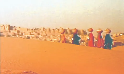
  • The Western Ghats: Western Ghats are parallel to the western coast. They are continuous and can be crossed through passes only.
  • Different Nomenclature: These are known by various local names, including
    • Sahyadri in Maharashtra, 
    • Nilgiri Hills in Karnataka and Tamil Nadu, and 
    • Anaimalai Hills and Cardamom Hills in Kerala.
  • Western Ghats Versus Eastern Ghats: The Western Ghats are higher in elevation and more continuous compared to the Eastern Ghats.
    • Its average elevation is about 1,500 meters, increasing from north to south.
  • Notable Peaks: These include Anamudi (2,695 meters) on the Anaimalai Hills and Dodabetta (2,637 meters) on the Nilgiri Hills in western ghats.
    •  Anaimudi is the highest peak on the Peninsular plateau.
    • Many of the major Peninsular rivers originate in the Western Ghats including Godavari, Krishna, Kaveri, Mahanadi etc. 
  • The Eastern Ghats: These consist of discontinuous and low hills, which have been significantly eroded by above mentioned rivers. 
    • Notable Ranges: Some important hill ranges within the Eastern Ghats include the Javadi Hills, Palconda Range, Nallamala Hills, and Mahendragiri Hills (the highest peak in the Eastern Ghats). 
      • Shevroy Hills and the Javadi Hills are located to the southeast of the Eastern Ghats.
  • The Eastern and Western Ghats converge at the Nilgiri Hills.
  • Soil Composition: The western and northwestern part of the plateau is marked by the presence of black soil. 
  • Deccan Trap: One of the distinct features of the Peninsular plateau is the black soil area. It is known as the Deccan trap.
    • This is of volcanic origin, hence, the rocks are igneous. 
    • These rocks have denuded over time and are responsible for the formation of black soil.

The Central Highlands and their connection to the Deccan Plateau

  •  Geographical Features of the Deccan Plateau: They are bounded by the Aravali range to the west. Satpura range, with plateaus at 600-900 m elevation, forms the northern boundary of the Deccan plateau.
    • An eastern extension, the Rajmahal Hills, is followed by the mineral-rich Chotanagpur plateau to the south.
  • Composition of the Central Highlands: These highlands are relict mountains, highly denuded, and exist as disjointed ranges.
    • The Peninsular plateau extends to Jaisalmer in the west, covered by sand ridges and crescent-shaped sand dunes (barchans).
    • Metamorphic processes have shaped the region, evidenced by rocks like marble, slate, and gneiss.
  •  Elevation of the Central Highlands:  It generally ranges from 700-1,000 m above sea level, sloping north and northeast.
  • River Origins: Vindhyan, Kaimur, and Aravalli Connections: Many tributaries of the Yamuna River originate in the Vindhyan and Kaimur ranges.
    • The Aravalli range in the west gives rise to the Banas, a significant tributary of the Chambal River. 

The Northeastern Plateau: An Extension of the Deccan Plateau

  • It is an extension of the main Peninsular plateau.
  • Plateau Evolution: From Formation to Detachment: It was formed due to the north-eastward movement of the Indian plate during the Himalayan formation.
    • It  resulted in a significant fault between the Rajmahal hills and the Meghalaya plateau.
    • This depression(fault) was later filled by river deposition, leading to the detachment of the Meghalaya and Karbi Anglong plateau from the main Peninsular Block.
  • Meghalaya Plateau: Tribal Regions, Resources, and Extensions: It is subdivided into three regions: The Garo Hills, the Khasi Hills, and the Jaintia Hills are all named after local tribal groups.
    • An extension of this plateau is observed in the Karbi Anglong hills of Assam.
    • Mineral Resources: Similar to the Chotanagpur plateau, the Meghalaya plateau is rich in mineral resources, including coal, iron ore, sillimanite, limestone, and uranium.
  • Meghalaya Plateau: Rainfall Erosion and Unique Landscape: This region receives maximum rainfall from the southwest monsoon, resulting in a highly eroded surface.
    • Cherrapunji, in the Meghalaya plateau, is known for its bare rocky surface without a permanent vegetation cover due to heavy rainfall.

The Indian Desert: Adjacent to the Deccan Plateau

 The India Desert

The India Desert

  • Desert Wonders: Barchans and Sandy Plains: Located northwest of the Aravali hills, it’s characterized by undulating topography with longitudinal dunes, barchans and sandy plains.
    • Barchans, which are crescent-shaped dunes, cover extensive areas.
  • Marusthali Chronicles: Exploring the Arid Realms: Desert area receives minimal rainfall, averaging below 150 mm per year, resulting in an arid climate and sparse vegetation. (Refer Figure)
    • Also known as Marusthali due to its distinctive features.
    • Low precipitation and high evaporation create a water deficit region.
  • Fossil Tales: Discovering Ancient Marine Deposits in Brahmsar: Believed to have been underwater during the Mesozoic era.
    • Its evidence of which has been found in wood fossils in Aakal.
    • Marine deposits found near Brahmsar (estimated to be 180 million years old).
  • Surface Features of the Indian Desert: While the underlying rock structure is an extension of the Peninsular plateau, surface features have been shaped by physical weathering and wind actions.
    • Prominent desert features include mushroom rocks, shifting dunes, and oases (primarily in the southern part).
  • Dividing the Indian Desert Landscape: The desert can be divided into northern and southern parts based on their orientation, sloping towards Sindh and the Rann of Kachchh, respectively.
  •  Watercourses and Disappearances in the Indian Desert: 
    • Streams briefly appear during the rainy season but often disappear into the desert sands as they lack sufficient water to reach the sea. 
    • Rivers in the region are mostly ephemeral, with the Luni River being the largest in the region.
    • Some streams vanish into the sand and exhibit inland drainage by joining lakes or playas.
  • Lakes and playas have brackish water, a major source of salt production.


Must Read
Current Affairs Editorial Analysis
Upsc Notes  Upsc Blogs 
NCERT Notes  Free Main Answer Writing
Print Friendly, PDF & Email

 Final Result – CIVIL SERVICES EXAMINATION, 2023.   Udaan-Prelims Wallah ( Static ) booklets 2024 released both in english and hindi : Download from Here!     Download UPSC Mains 2023 Question Papers PDF  Free Initiative links -1) Download Prahaar 3.0 for Mains Current Affairs PDF both in English and Hindi 2) Daily Main Answer Writing  , 3) Daily Current Affairs , Editorial Analysis and quiz ,  4) PDF Downloads  UPSC Prelims 2023 Trend Analysis cut-off and answer key

THE MOST
LEARNING PLATFORM

Learn From India's Best Faculty


 Final Result – CIVIL SERVICES EXAMINATION, 2023.   Udaan-Prelims Wallah ( Static ) booklets 2024 released both in english and hindi : Download from Here!     Download UPSC Mains 2023 Question Papers PDF  Free Initiative links -1) Download Prahaar 3.0 for Mains Current Affairs PDF both in English and Hindi 2) Daily Main Answer Writing  , 3) Daily Current Affairs , Editorial Analysis and quiz ,  4) PDF Downloads  UPSC Prelims 2023 Trend Analysis cut-off and answer key

Quick Revise Now !
AVAILABLE FOR DOWNLOAD SOON
UDAAN PRELIMS WALLAH
Comprehensive coverage with a concise format
Integration of PYQ within the booklet
Designed as per recent trends of Prelims questions
हिंदी में भी उपलब्ध
Quick Revise Now !
UDAAN PRELIMS WALLAH
Comprehensive coverage with a concise format
Integration of PYQ within the booklet
Designed as per recent trends of Prelims questions
हिंदी में भी उपलब्ध

<div class="new-fform">


    </div>

    Subscribe our Newsletter
    Sign up now for our exclusive newsletter and be the first to know about our latest Initiatives, Quality Content, and much more.
    *Promise! We won't spam you.
    Yes! I want to Subscribe.