Researchers have identified a previously unknown Mayan city hidden within Mexico’s dense jungle using LiDAR (Light Detection and Ranging) technology.
Mayan civilization
-
- This civilization was a Mesoamerican culture.
- Known for: Ancient temples, glyphs (written script), sophisticated art, architecture, mathematics, and astronomical systems.
- Geography: It covered areas including southeastern Mexico and northern Central America.
- Art and Architecture
-
-
- Cultural Sophistication: They created art using materials like wood, jade, obsidian, ceramics, and stone for sculptures.
- Building Types: Architecture included pyramid-temples, palaces, and ceremonial ball courts.
- Political Structure
-
- The king acted as a link between god and people.
- He was usually selected from the patrilineal line.
|
- This technology enabled them to bypass thick vegetation and locate the ancient city.
- It is now named Valeriana, in Mexico’s Campeche region.
- The city features pyramids, plazas, a ballcourt, and a reservoir.
Enroll now for UPSC Online Classes
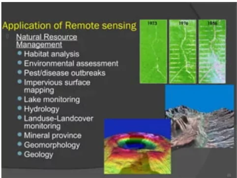
What is remote sensing technology?
-
- It is a process in which physical characteristics of an area are detected and monitored.
- It is done through the measurement of reflected and emitted radiation at a distance typically from a satellite.
-
Special cameras capture remotely sensed images.
-
-
- It helps researchers in sensing things about the earth.
What is LiDAR?
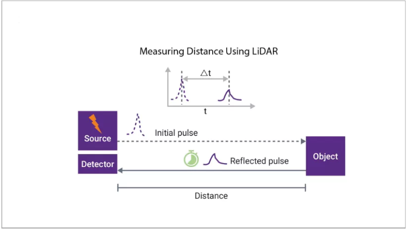
- LiDAR refers to Light Detection and Ranging.
 It is a remote sensing technology that uses laser pulses to measure distances between a sensor and the Earth’s surface.
- By analyzing the reflected light, LiDAR creates detailed 3D maps of the terrain.
- Types of LiDAR
- Topographic: It maps earth surface and captures land features above water.
- Bathymetric: This lidar measures underwater and maps the seafloor.
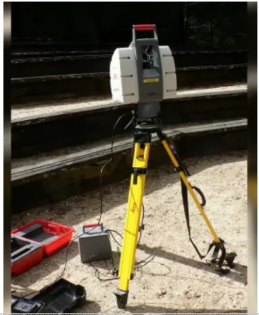
How does LiDAR Work?
- Components: LiDAR technology includes a laser, scanner, and GPS receiver.
- Process:
- Laser pulses hit surfaces such as vegetation, buildings, or land features.
- The reflected light is recorded, and two-way travel time of each pulse is measured.
- GPS and Inertial Measurement System (IMS) data are combined to determine distances and generate elevation maps.
 Point Cloud Data:
-
- The collected data appears as a point cloud that records reflections from various surfaces.
- Scientists analyze these reflections to identify different features (e.g., vegetation vs. buildings).
- Digital Elevation Model:
- Data can be refined to produce a “bare earth” model, which removes trees and structures, showing only ground elevation.
LiDAR’s Importance in Archaeology
- Rapid Survey of Large Areas: LiDAR can quickly scan vast areas, uncovering hidden structures and features.
- Penetrating Dense Vegetation: It can see through dense vegetation, revealing archaeological sites that would otherwise be obscured.
- High-Resolution Mapping: LiDAR provides detailed 3D maps which allow for precise analysis of ancient settlements.
-
-
- These maps are valuable for geographers, conservationists, and engineers.
- Non-Invasive Exploration: It minimizes damage to archaeological sites, preserving them for future study.
- High Efficiency: Unlike traditional methods, which involve labor-intensive exploration, LiDAR allows scientists to analyze vast areas quickly from labs.
Challenges of LiDAR Systems
Despite its many benefits, LiDAR technology faces some challenges:
- Isolating the Signal: LiDAR systems need to distinguish the weak reflected signal from the much stronger outgoing laser beam.
- This ensures the sensor accurately detects targets and avoids being overwhelmed by its own light.
- Atmospheric Interference: Dust, fog, and other airborne particles can create false readings by reflecting the laser beam before it reaches its intended target.
- Power Limitations: Stronger laser beams provide more accurate data but require more power and are more expensive to operate.
- Safety Concerns: High-powered lasers can be dangerous to human eyes.
- Device Crosstalk: Signals from nearby LiDAR devices can interfere with each other.
- Cost and Maintenance: LiDAR systems can be expensive compared to other sensors.
- Unintended Object Returns: LiDAR might pick up reflections from unwanted objects like birds or flying debris.
Applications of LiDAR Technology
- Atmospheric Sciences: Used to study atmospheric particles, wind patterns, clouds, and weather profiles.
- Astronomy: LiDAR helps measure distances to distant objects like the Moon with high precision and creates guide stars for telescopes.
- Automobile Industry: LiDAR is a key sensor in self-driving vehicles, working alongside cameras and radar to detect objects in the environment.
- Topographic and Bathymetric Mapping: Topographic LiDAR uses infrared to map land, while bathymetric LiDAR uses green light to map underwater features like riverbeds and seafloors.
- Agriculture: Helps map land topology, monitor crop growth, and assess needs for fertilizers and irrigation.
- Archaeology: Enables mapping of ancient structures under dense vegetation, such as old roadways and ruins.
- Environmental and Coastal Management: Supports flood modeling, shoreline mapping, emergency response, and vulnerability assessments for coastal areas.
- Consumer Electronics: Miniature LiDAR is now used in mobile phones, enhancing 3D scanning and augmented reality applications.
Enroll now for UPSC Online Classes


 4 Nov 2024


.png)


 Current Affairs


 GS Foundation
 Optional Course
 Combo Courses
 Degree Program