Udaan, Prahaar, Q&A Bank etc.
CA Magazines & Editorials
 June 20, 2024
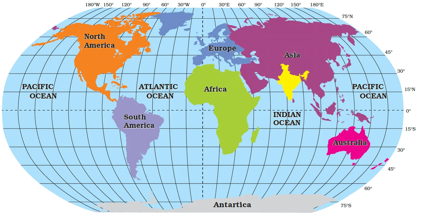
India is a country of vast geographical expanse. It covers an area of 3.28 million square kilometres, accounting for 2.4 per cent of the world’s total area. In the north, it is bound by the lofty Himalayas, in the west lies the Arabian Sea, in the east lies the Bay of Bengal and in the south lies the Indian Ocean, washing the shores of the Indian peninsula.
|
POINTS TO PONDER Historically, India’s location has helped her to maintain a central position in world trade throughout most of her history. On the other hand, It has hindered the growth of Indian Political Entities and restricted them within the confines of the Himalayas and the Indian Ocean. Do you think India’s location in the world map is a double edged sword. If yes, find out the positives and negatives emanating due to the location of India. |
|---|
| Additional Information
Since the opening of the Suez Canal in 1869, India’s distance from Europe, has been reduced by 7,000 km. The Suez Canal is Artificial sea level waterway connecting Indian Ocean to Pacific Ocean. |
|---|
India and the World
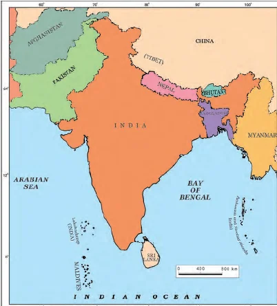
India and its neighbours
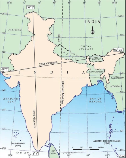
India: Extent and Standard Meridian
|
Do You Know ? 82°30’E has been selected as the Standard Meridian of India as it passes through the centre of India. |
|---|
India’s Coastal Limit: It extends towards the sea up to 12 nautical miles (about 21.9 km) from the coast.
Physical Divison
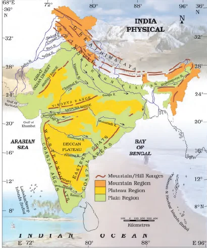 Standing as sentinels in the north are the lofty snow-capped Himalayas.
|
Do you know? The Ganga and the Brahmaputra form the world’s largest delta, the Sundarbans delta. The delta is triangular in shape. It is an area of land formed at the mouth of the river (Where rivers enter the sea, that point is called the mouth of the sea). |
|---|
|
Do You Know ? The southernmost point of the Indian Union– ‘Indira Point’ got submerged under the sea water in 2004 during the Tsunami. |
|---|
Do You Know ?
|
|---|
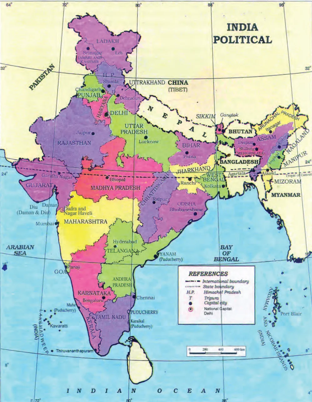
India Political Map
| Do You Know ?
Corals are skeletons of tiny marine animals called Polyps. When the living polyps die, their skeletons are left. Other polyps grow on top of the hard skeleton which grows higher and higher, thus forming the coral islands. |
|---|
Administrative division: States, Union Territories, and the National Capital
Glossary
|
|---|
| Must Read | |
| Current Affairs | Editorial Analysis |
| Upsc Notes | Upsc Blogs |
| NCERT Notes | Free Main Answer Writing |
Explore SRIJAN Courses


Connect with our experts to get free counselling & start preparing
Join India’s trusted platform for expert guidance, quality content, proven success.
Learn anytime, anywhere.


India's leading UPSC coaching platform helping aspirants prepare for IAS, IPS, IFS and other Civil Services examinations with the best faculty and proven strategies.
<div class="new-fform">
</div>