Win up to 100% Scholarship

Register Now

NCERT NOTES

Elevate your UPSC preparation with NCERT Notes – because every word matters on your journey to success.

The Northern Plains: India’s Fertile Alluvial Heartland of India

December 8, 2023 551 0

Northern Plains of India: 

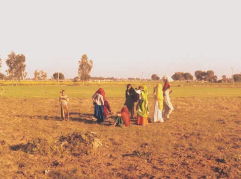
The Northern Plains, a vast alluvial region, results from the convergence of three major river systems: the Indus, the Ganga, and the Brahmaputra, along with their tributaries. Stretching around 3,200 kilometers from east to west and varying in width from 150-300 kilometers, this fertile plain is rich in alluvial soil. 

Over millions of years, sediment deposition at the base of the Himalayas created this highly productive agricultural area, covering approximately 7 lakh sq. km and supporting a dense population.

The Northern Plains

The Northern Plains

Breaking down the Northern Plains: A Geographical Overview

The Northern Plains is broadly divided into three sections. 

  • Punjab Plains: Indus and Tributaries Carving Doabs: The Western part of the Northern Plains is referred to as the Punjab Plains. 
    • It was formed by the Indus and its tributaries, the larger part of this plain lies in Pakistan.
    • The Indus and its tributaries — the Jhelum, the Chenab, the Ravi, the Beas and the Satluj originate in the Himalaya.
    • This section of the plain is dominated by the doabs.
  • The Ganga Plain: From Ghaggar to Teesta: It extends between Ghaggar and Teesta rivers
    • It is spread over North India in Haryana, Delhi, U.P., Bihar, partly Jharkhand and West Bengal. 
  • The Brahmaputra Plain: Eastern Expanse in Assam: It lies in the east, particularly in Assam.

Northern Plains: What Defines its Features and Significance?

  • Diverse Zones of the Northern Plains: The northern plains are generally described as flat land with no variations in its relief but the Northern Plains features diverse zones.  
    • According to the variations in relief features, the Northern plains can be divided into four regions.
    • Bhabar:  The rivers, after descending from the mountains, deposit pebbles in a narrow belt of about 8 to 16 km in width lying parallel to the slopes of the Shiwaliks.
      • All the streams disappear in this bhabar belt.
    • Terai Region and Dudhwa National Park: South of this belt, the streams and rivers re-emerge and create a wet, swampy and marshy region known as terai. 
      • Dudhwa National Park is situated in the Terai region, a swampy area characterized by rich natural vegetation and diverse wildlife.
    • Bhangar: The largest part of the northern plains is formed of older alluvium. 
      • It lies above the floodplains of the rivers and presents a terracelike feature
      • This part is known as bhangar.
      • The soil in this region contains calcareous deposits, locally known as kankar.
    • Agricultural Riches of Khadar in the Northern Plains: The newer, younger deposits of the floodplains are called khadar.
      • They are renewed almost every year and so are fertile, thus, ideal for intensive agriculture.
  • Diverse Relief Features of the Northern Plains: The region exhibits various relief features, such as sandbars, meanders, oxbow lakes, and braided channels formed by the rivers.
  • Doab and the Bountiful Punjab Region: A distinctive geographical feature is the ‘Doab,’ representing fertile land between two rivers. 
    • The ‘Punjab’ region, derived from ‘Punj’ (five) and ‘ab’ (water), signifies the presence of five major rivers.
  • A Water Divide between Indus and Ganga: Haryana and Delhi act as water divide between the Indus and Ganga river systems. 
  • Dhubri, located in Assam, marks a significant point in the course of the Brahmaputra River. 
    • Here, the river takes a nearly 90° southward turn before entering Bangladesh.
  • The Brahmaputra plains exhibit riverine islands, sandbars, and periodic floods, forming braided streams and deltas.
    • Majuli, located in the Brahmaputra River, stands as the world’s largest inhabited riverine island. 
    • The Brahmaputra River flows from northeast to southwest, impacting the geography of the Northern Plains.
  • Large Population: Fertile Plains and a Flourishing Population: These fertile alluvial plains support a large population due to their agricultural productivity.

Geological Wonders: Northern Plains and Peninsular Plateau in India

The Peninsular Plateau is an ancient tableland composed of crystalline, igneous, and metamorphic rocks, standing in contrast to the Northern Plains, a vast alluvial region.

Peninsular Plateau: Varied Geological Features and Northern Plains

  • Size and Shape: Rising from the height of 150 m above the river plains up to an elevation of 600-900 m is the irregular triangle known as the Peninsular Plateau.
  • Geological Stability and Elevation Patterns: It is one of the oldest and the most stable landmass of India with a general elevation of the plateau from the west to the east, which can be seen in the pattern of the flow of rivers.
  • Formation: It formed due to the breaking and drifting of the Gondwana land, making it one of the oldest land masses.
  • Geographical Extent: Delhi ridge in the northwest, (extension of Aravalis), the Rajmahal hills in the east, Gir range in the west and the Cardamom hills in the south constitute the outer extent of the Peninsular plateau, including the adjacent Northern Plains.
    • Along with an extension of this seen in the northeast, in the form of Shillong and Karbi-Anglong plateau. 
  • Division of Peninsular Plateau: It is made up of a series of patland plateaus like the Hazaribagh plateau, the Palamu plateau, the Ranchi plateau, the Malwa plateau, the Coimbatore plateau and the Karnataka plateau, etc. 
  • Tectonic Activity in the Peninsular Plateau: It has gone through recurrent phases of upliftment and submergence along with crustal faulting and fractures. 
    • Example: Bhima fault in Maharashtra which experiences recurrent seismic activity.
    • These features have diversified the relief of the plateau. Some of them, like the northwest complex reliefs, gorges and ravines of Chambal, Bhind and Morena are some of the well-known examples.

Peninsular Plateau

  • A few notable features of this region are tors, block mountains, rift valleys, spurs, bare rocky structures, series of hummocky hills and wall-like quartzite dykes which are natural sites for water storage.
  • Geographic Subdivisions of the Peninsular Plateau: On the basis of the prominent relief features, the Peninsular Plateau can be divided into three broad groups: Deccan Plateau, Central Highland, and N-E Plateau. 

The Deccan Plateau: Southern Landscape Below the Narmada

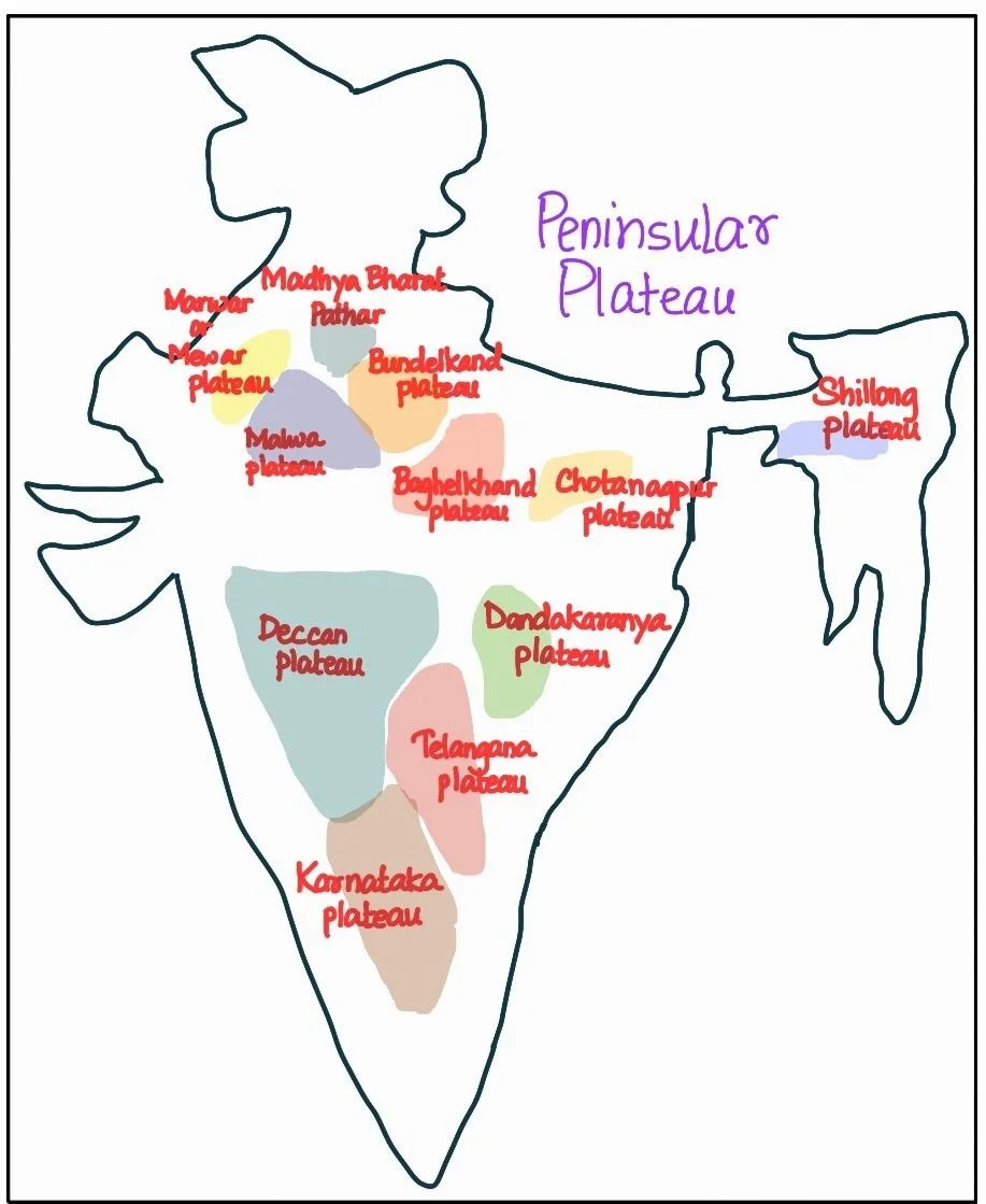
The Deccan Plateau is a triangular landmass that lies to the south of the river Narmada.

What Roles do the Deccan Plateau and Northern Plains Play in Shaping India’s Geography?

  • Geographical Features Surrounding the Deccan Plateau: The Deccan Plateau is surrounded by geographical features:
    • Western Ghats in the west
    • Eastern Ghats in the east
    • Satpura, Maikal range, and Mahadeo hills in the north.
  • Western Ghats: Peaks, Passes, and Local Names: Western Ghats are parallel to the western coast. They are continuous and can be crossed through passes only.
    • Western Ghats: Names and Stories of a Rich Landscape: These are known by various local names, including
      • Sahyadri in Maharashtra, 
      • Nilgiri Hills in Karnataka and Tamil Nadu, and 
      • Anaimalai Hills and Cardamom Hills in Kerala.
    • Western Ghats Versus Eastern Ghats: The Western Ghats are higher in elevation and more continuous compared to the Eastern Ghats.
      • Its average elevation is about 1,500 meters, increasing from north to south.
    • Notable Peaks: Anamudi and Dodabetta in the Western Ghats: These include Anamudi (2,695 meters) on the Anaimalai Hills and Dodabetta (2,637 meters) on the Nilgiri Hills in western ghats.
      •  Anaimudi is the highest peak on the Peninsular plateau.
    • Many of the major Peninsular rivers originate in the Western Ghats including Godavari, Krishna, Kaveri, Mahanadi etc. 

POINTS TO PONDER

The Deccan Traps are a distinct landscape found in and around Maharashtra region. Find out the unique characteristics of the Traps and the reason for its formation. Can you link the reason with the resources available in this area, particularly, the Black soil.
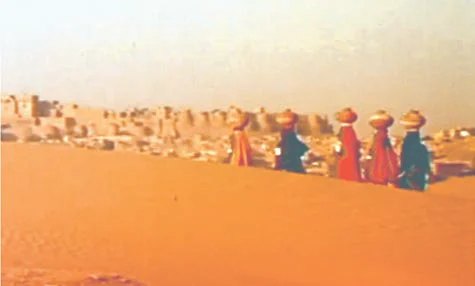
  • The Eastern Ghats: Diverse Terrain and Notable Ranges: These consist of discontinuous and low hills, which have been significantly eroded by above mentioned rivers. 
    • Notable Ranges: Some important hill ranges within the Eastern Ghats include the Javadi Hills, Palconda Range, Nallamala Hills, and Mahendragiri Hills (the highest peak in the Eastern Ghats). 
      • Shevroy Hills and the Javadi Hills are located to the southeast of the Eastern Ghats.
  • The Eastern and Western Ghats converge at the Nilgiri Hills.
  • Soil Composition of the Western Peninsular Plateau: The western and northwestern part of the plateau is marked by the presence of black soil. 
  • Deccan Trap: The origin of Peninsular Plateau’s Black Soil: One of the distinct features of the Peninsular plateau is the black soil area. It is known as the Deccan trap.
    • This is of volcanic origin, hence, the rocks are igneous. 
    • These rocks have denuded over time and are responsible for the formation of black soil.

The Central Highlands: Geographical Features and Influence on Northern Plains and River Systems

  • Geographical Extent: From Aravali to Chotanagpur Plateau: They are bounded by the Aravali range to the west. Satpura range, with plateaus at 600-900 m elevation, forms the northern boundary of the Deccan plateau.
    • An eastern extension, the Rajmahal Hills, is followed by the mineral-rich Chotanagpur plateau to the south.
  • Relict Mountains and Metamorphic Marvels of Central Highlands: These highlands are relict mountains, highly denuded, and exist as disjointed ranges.
    • The Peninsular plateau extends to Jaisalmer in the west, covered by sand ridges and crescent-shaped sand dunes (barchans).
    • Metamorphic processes have shaped the region, evidenced by rocks like marble, slate, and gneiss.
  • Elevation of central highlands:  It generally ranges from 700-1,000 m above sea level, sloping north and northeast.
  • Rivers: Yamuna Tributaries and Aravalli-Born Banas: Many tributaries of the Yamuna River originate in the Vindhyan and Kaimur ranges.
    • The Aravalli range in the west gives rise to the Banas, a significant tributary of the Chambal River. 

The Northeastern Plateau: Formation, Detachment, and Rich Mineral Resources Influencing the Northern Plains

  • It is an extension of the main Peninsular plateau.
  • Formation and Detachment of Meghalaya and Karbi Anglong Plateau : It was formed due to the north-eastward movement of the Indian plate during the Himalayan formation.
    • It  resulted in a significant fault between the Rajmahal hills and the Meghalaya plateau.
    • This depression(fault) was later filled by river deposition, leading to the detachment of the Meghalaya and Karbi Anglong plateau from the main Peninsular Block.
  • The Meghalaya plateau: Tribal Hills, Mineral Riches, and Assam’s Karbi Anglong Extension: It is subdivided into three regions: The Garo Hills, the Khasi Hills, and the Jaintia Hills are all named after local tribal groups.
    • An extension of this plateau is observed in the Karbi Anglong hills of Assam.
    • Mineral Resources: Similar to the Chotanagpur plateau, the Meghalaya plateau is rich in mineral resources, including coal, iron ore, sillimanite, limestone, and uranium.
  • Cherrapunji: Meghalaya’s Rain-Drenched Plateau and Eroded Landscape: This region receives maximum rainfall from the southwest monsoon, resulting in a highly eroded surface.
    • Cherrapunji, in the Meghalaya plateau, is known for its bare rocky surface without a permanent vegetation cover due to heavy rainfall.

The Indian Desert: Arid Landscape, Unique Features, and Seasonal Waterways shaping the Northern Plains

  • Features and Dunes of the Northwestern Indian Desert: Located northwest of the Aravali hills, it’s characterized by undulating topography with longitudinal dunes, barchans and sandy plains.
    • Barchans, which are crescent-shaped dunes, cover extensive areas.
  • Marusthali: The Arid Beauty of Northwestern Indian Desert: Desert area receives minimal rainfall, averaging below 150 mm per year, resulting in an arid climate and sparse vegetation. (Refer Figure)

The India Desert

The India Desert

    • Also known as Marusthali due to its distinctive features.
    • Low precipitation and high evaporation create a water deficit region.
  • Ancient Marine Secrets of Northwestern Indian Desert: Believed to have been underwater during the Mesozoic era.
    • Its evidence of which has been found in wood fossils in Aakal.
    • Marine deposits found near Brahmsar (estimated to be 180 million years old).
  • Surface Features of the Northwestern Indian Desert: While the underlying rock structure is an extension of the Peninsular plateau, surface features have been shaped by physical weathering and wind actions.
    • Prominent desert features include mushroom rocks, shifting dunes, and oases (primarily in the southern part).
  • Northern and Southern Dimensions of the Indian Desert: The desert can be divided into northern and southern parts based on their orientation, sloping towards Sindh and the Rann of Kachchh, respectively.
  • Ephemeral Rivers and Seasonal Waterways of the Indian Desert: 
    • Streams briefly appear during the rainy season but often disappear into the desert sands as they lack sufficient water to reach the sea. 
    • Rivers in the region are mostly ephemeral, with the Luni River being the largest in the region.
    • Some streams vanish into the sand and exhibit inland drainage by joining lakes or playas.
  • Lakes and playas have brackish water, a major source of salt production.

 Final Result – CIVIL SERVICES EXAMINATION, 2023.   Udaan-Prelims Wallah ( Static ) booklets 2024 released both in english and hindi : Download from Here!     Download UPSC Mains 2023 Question Papers PDF  Free Initiative links -1) Download Prahaar 3.0 for Mains Current Affairs PDF both in English and Hindi 2) Daily Main Answer Writing  , 3) Daily Current Affairs , Editorial Analysis and quiz ,  4) PDF Downloads  UPSC Prelims 2023 Trend Analysis cut-off and answer key

THE MOST
LEARNING PLATFORM

Learn From India's Best Faculty


 Final Result – CIVIL SERVICES EXAMINATION, 2023.   Udaan-Prelims Wallah ( Static ) booklets 2024 released both in english and hindi : Download from Here!     Download UPSC Mains 2023 Question Papers PDF  Free Initiative links -1) Download Prahaar 3.0 for Mains Current Affairs PDF both in English and Hindi 2) Daily Main Answer Writing  , 3) Daily Current Affairs , Editorial Analysis and quiz ,  4) PDF Downloads  UPSC Prelims 2023 Trend Analysis cut-off and answer key

Quick Revise Now !
AVAILABLE FOR DOWNLOAD SOON
UDAAN PRELIMS WALLAH
Comprehensive coverage with a concise format
Integration of PYQ within the booklet
Designed as per recent trends of Prelims questions
हिंदी में भी उपलब्ध
Quick Revise Now !
UDAAN PRELIMS WALLAH
Comprehensive coverage with a concise format
Integration of PYQ within the booklet
Designed as per recent trends of Prelims questions
हिंदी में भी उपलब्ध

<div class="new-fform">


    </div>

    Subscribe our Newsletter
    Sign up now for our exclusive newsletter and be the first to know about our latest Initiatives, Quality Content, and much more.
    *Promise! We won't spam you.
    Yes! I want to Subscribe.