Core Demand of the Question
- Distribution and Density of Population in the Ganga River Basin
- Role of Land Resource
- Role of Soil Resource
- Role of Water Resource
- Other Contributing factors
|
Introduction
The Ganga River Basin, covering about 27% of India’s geographical area across 11 states, supports the largest population concentration (47% of its population) in the country. Its distribution and density of population are deeply linked to the availability of fertile alluvial soils, abundant water resources, and cultivable land, making it one of the most densely populated regions of the world.
Body
![]()
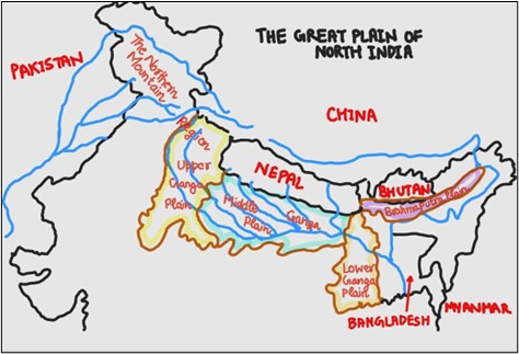
Fig: Ganga River Basin
Distribution and Density of Population in the Ganga River Basin
- Upper Ganga Basin
- Low Density due to Terrain: Uttarakhand and Himalayan parts of the basin have rugged mountains and steep slopes, restricting agriculture and habitation. Population density in Uttarakhand (2011 Census) is 189 persons/km², much below the basin average (Census of India 2011).
- Valley Concentrations: Densities rise in valley towns such as Dehradun (550/km²) and Haridwar (801/km²) where flat alluvial terraces and irrigation support settlements.
- Middle Ganga Basin
- Very High Densities: Uttar Pradesh (828/km²) and Bihar (1,102/km²) are among the most densely populated states of India (Census 2011). Fertile plains and water availability explain these concentrations.
- Urban–Rural Clusters: Cities like Kanpur, Prayagraj, Varanasi, and Patna cluster along rivers, creating dense linear settlements.
- Lower Ganga Basin
- Deltaic Concentration: West Bengal has 1,029/km² density (Census 2011), with extremely high values in the Ganga–Brahmaputra delta. Flat terrain and fertile soils sustain this intensity.
- Urban Regions: The Kolkata Metropolitan Area (~14.8 million people, Census 2011) stands out as a mega-urban cluster, benefiting from port location and dense transport networks.
Role of Land Resource
- Flat Alluvial Plains: The extensive plains of UP, Bihar, and West Bengal provide cultivable land, encouraging dense agrarian and urban settlements.
- Ease of Transport: Level terrain facilitates rail–road networks and market linkages, reinforcing high rural and urban densities.
- Mountainous Upper Basin: Limited arable land in the upper reaches explains sparse settlements in Uttarakhand and Himachal parts of the basin.
Role of Soil Resource
- Fertile Alluvial Soils: Deep alluvium supports rice–wheat farming and multiple cropping, sustaining large rural populations (Source: ICAR, Soil Resource Atlas of India).
- Doab Advantage: The Ganga–Yamuna Doab is one of the most productive tracts of India, explaining the dense settlement belt in western UP.
- Deltaic Soils: Nutrient-rich silt soils in West Bengal delta support intensive rice cultivation, balancing risks of flooding with very high rural density.
Role of Water Resource
- Perennial Rivers: The Ganga and its tributaries (Yamuna, Ghaghara, Gandak, Kosi, Son) ensure reliable irrigation and domestic supply, underpinning population density (NMCG, Govt of India).
- Canal Irrigation Systems: The Upper Ganga Canal (constructed 1854, still vital) irrigates ~9,000 km², boosting agriculture in western UP (UP Irrigation Dept).
- Deltaic Water Abundance: Extensive groundwater and distributaries in lower basin sustain both agriculture and cities like Kolkata, further raising density.
While land, soil, and water resources form the core basis for high population density in the Ganga Basin, other factors also played a crucial role, such as
Other Contributing Factors
- Historical and Cultural Factors: The Ganga valley has been a cradle of civilization since ancient times, hosting sacred cities like Varanasi, Prayagraj, and Haridwar, which continue to attract dense permanent and pilgrim populations.
- Economic and Industrial Development: Industrial hubs such as Kanpur (textiles, leather), Patna (trade), and Kolkata (port-based industries) drive urbanisation and migration, reinforcing high population densities.
- Infrastructure and Connectivity: Dense networks of railways, roads, and inland waterways in the basin enhance mobility and access to markets, encouraging concentrated settlements along major transport corridors.
Conclusion
The Ganga Basin’s dense population thrives on fertile soils, flat land, and perennial water. To sustain this pressure, tech-enabled tools like GIS and remote sensing must be harnessed for mapping resources and ensuring their optimum utilization, thereby balancing development with environmental safeguards.


 Current Affairs


 GS Foundation
 Optional Course
 Combo Courses
 Degree Program


