Books

India Political Map 2026 explains states, union territories, capitals, and recent changes after Article 370 abrogation, including Jammu and Kashmir reorganization. This guide helps UPSC aspirants understand boundaries, administrative structure, key features, and geopolitical updates essential for prelims and mains.
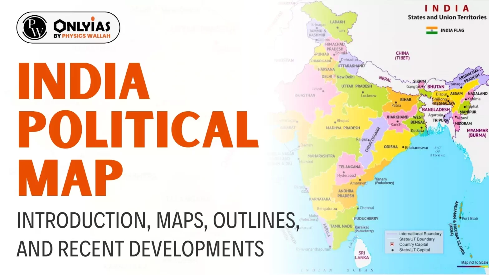
India political Map: India is the seventh biggest country globally and the second most populated. Since the abrogation of Article 370 the political map of India has been changed internally and boundaries have been altered. However, understanding the political map of India is crucial for aspirants preparing for the UPSC exams. Here we will go through the comprehensive coverage of the political map of India.
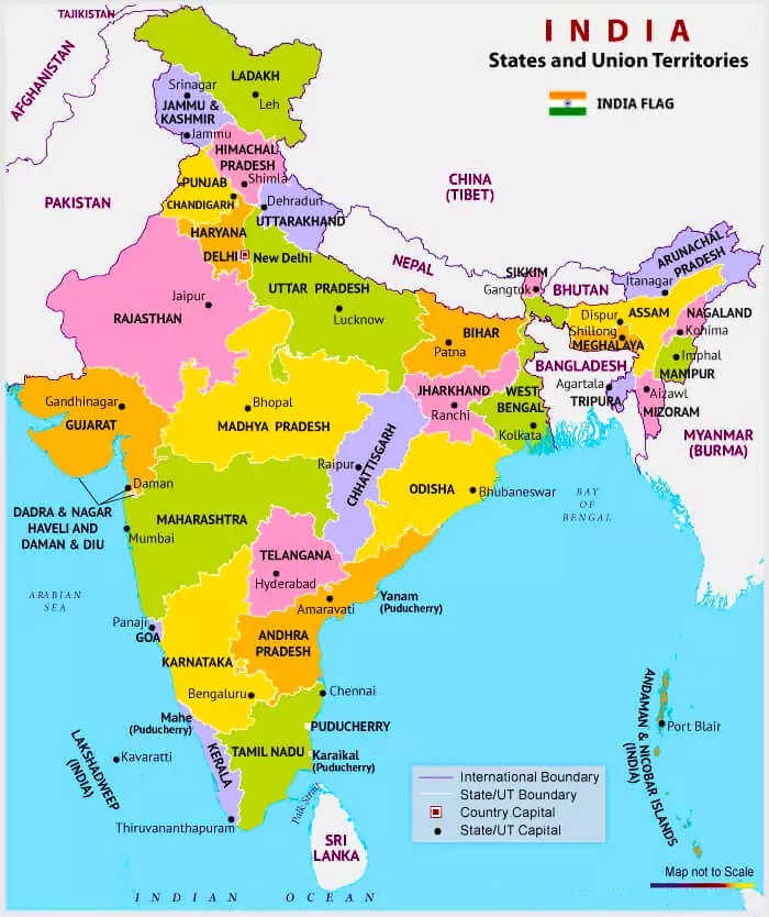
A Political Map of India represents all states of any country along with its capital. India political Map is divided into 28 states and 8 union territories (UTs), each state and Union Territories having its own unique identity, history, and central administrative location.
States and some union territories are administered by the elected government by the people of states whereas Union Territories are directly administered by the President.
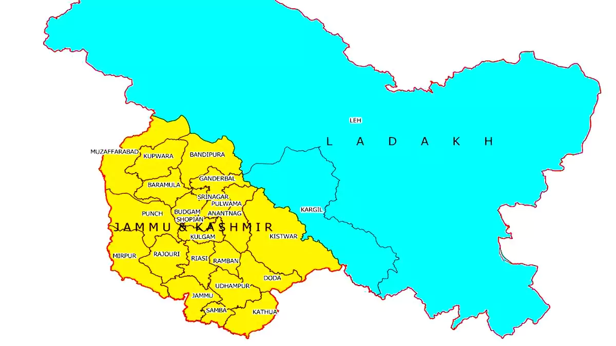
| Ladakh Union Territory without Legislature | ||
| Jammu and Kashmir Union Territory | Ladakh Union Territory | |
| Capital | Jammu(winter), Srinagar(summer) | Leh and Kargil |
| Area | 222,236 sq.km | 59,146 km sq.km |
| Districts | 20 | 2 districts namely Leh and Kargil. |
| Languages | Kashmiri, Dogri, Urdu, Hindi, and English | Hindi, English, Ladakhi, Purgi, Brokskat, and Balti |
Candidates preparing for the UPSC exam must practice the political map of India with states and union territories in order to learn the location and names of the states and union territories. The list of states and union territories on the political map of India are listed below:
| List of Indian States | List of Union Territories |
|
|
Indian political map has numerous features that help people to understand their state and their boundaries with adjacent states and with other countries.
| Must Read | |
| NCERT Notes For UPSC | UPSC Daily Current Affairs |
| UPSC Blogs | UPSC Daily Editorials |
| Daily Current Affairs Quiz | Daily Main Answer Writing |
| UPSC Mains Previous Year Papers | UPSC Test Series |
Explore UPSC Test Series

Political Map of India shows the total states and Union Territories of India along with their capitals and boundaries.
India covers an area of 32,87,263 sq. km which extends from the snow-covered Himalayan heights to the tropical rain forests of the south.
Political map demarcates the boundaries of states whereas the physical map is more concerned with the geological features and physiography of states
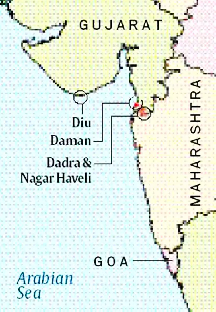
Dadra and Nagar Haveli and Daman and Diu and Jammu and Kashmir.
Agra is located in Uttar Pradesh state of India.
Hyderabad is located in Andhra Pradesh state of India.


Explore SRIJAN Prelims Crash Course

Connect with our experts to get free counselling & start preparing
Books
Udaan (Prelims Wallah)
Prahaar (Mains Wallah)
Q&A Bank (Prelims & Mains)
Budget & Economic Survey
NCERT Wallah
Marks Booster
हिंदी माध्यम विशेष शृंखला
 Current Affairs
Monthly Current Wallah
Subject Wise Current Affairs
Editorial Analysis
Editorial PDFs
News of The Day
Download Our App


Download Our App
<div class="new-fform">
</div>
 GS Foundation
 Optional Course
 Combo Courses
 Degree Program