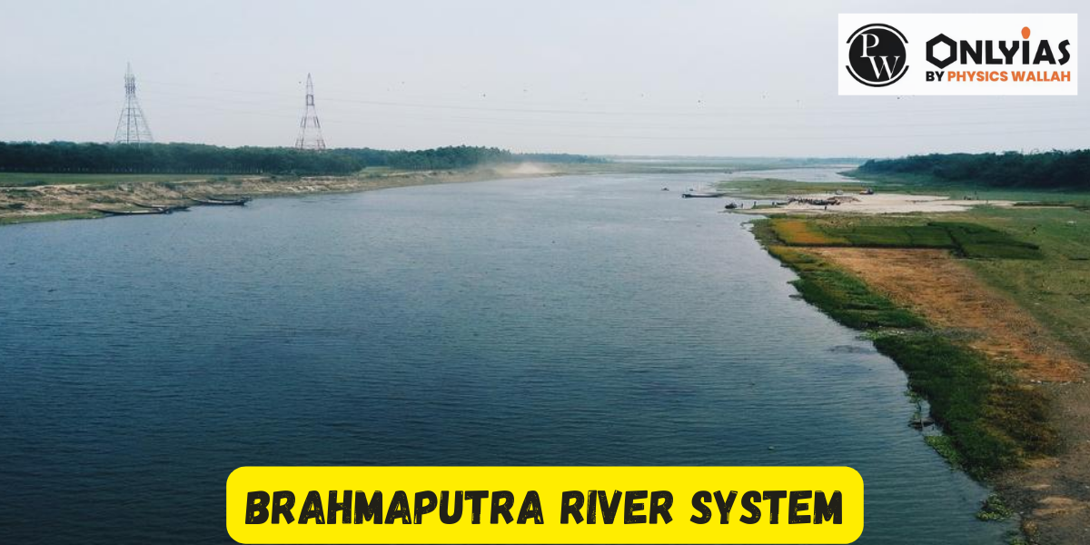
Brahmaputra River System—spanning 2,900 km across Tibet, India & Bangladesh. Learn about its origin, tributaries, floods, geography & UPSC relevance in this detailed guide.

Brahmaputra River System: The Brahmaputra River stands as one of the largest rivers globally and holds great significance in Asia. Notably, it is an international river. In contrast to most rivers in India, which are commonly associated with feminine attributes, the Brahmaputra is characterized as a masculine river. Its impressive length spans approximately 2900 kilometers.
Originating from the Yarlung Tsangpo River, a braided river flowing into the Brahmaputra, this mighty watercourse begins its journey in the southwestern regions of Tibet. The Yarlung Tsangpo River, with its source at the Angsi Glacier, winds its way through the Himalayas, eventually becoming the Dihang River upon entering Arunachal Pradesh. The Brahmaputra gains strength and widens as it approaches Assam, showcasing the force of its flow.
With a maximum depth of 120 meters and an average depth of 38 meters, the river’s waters are sourced from the melting Himalayan snow, contributing to seasonal flooding. The river discharges water at an average rate of 19,300 cubic meters per second, exemplifying its immense volume. Notably, the Brahmaputra is susceptible to avulsion and channel migration, factors that influence its dynamic nature.
The vast drainage area of the Brahmaputra encompasses various geographical features, including the Patkai-Bum hills, the northern slopes of the Meghalaya hills, the Assam plains, parts of the Tibetan plateau, and even northern Bangladesh. It drains portions of the Himalayas to the east of the Indo-Nepal border, the southern-central Tibetan plateau above the Ganges basin, as well as the southeastern Tibetan plateau.
The peak of this drainage area can be found at the majestic Kanchenjunga.

The course of the Brahmaputra River spans approximately 2900 kilometers, reaching depths of up to 120 meters while maintaining an average depth of 38 meters.
Originating at an elevation of 5300 meters in the Kailash hills of the Himalayas, the river journeys through Bangladesh and Assam before entering India via Arunachal Pradesh, ultimately merging with the Bay of Bengal. Its expansive catchment area in Tibet accounts for around 293,000 square feet, contributing to its vast influence and significant role in the region.

Geographical Boundaries of the Brahmaputra River System Situated on a vast continent, the Brahmaputra River system is encompassed by distinct natural boundaries. The northern border is marked by the towering Himalayas, while the eastern boundary is defined by the Patkai range of hills. To the south lies the Assam range of hills, while the western limits are shaped by the Himalayas and ridge formations.
This expansive river system, especially the regions within Assam, witnesses some of the world’s highest recorded rainfall patterns. Consequently, these areas are prone to annual floods and the erosion of riverbanks.
Snow-covered terrain adorns the Himalayan Mountain regions of Sikkim and Arunachal Pradesh, which are vital contributors to the Brahmaputra basin. Remarkably, these regions collectively account for a significant portion (55.48%) of India’s forest cover, making them among the greenest areas in the country.
Notable Landmarks and Features Majuli, recognized by UNESCO, is the world’s largest and oldest inhabited riverine island. This island, also designated as a district of Assam, occupies a unique place within the Brahmaputra river system. Additionally, the river system boasts an estimated hydropower potential of 66,065 megawatts. The Brahmaputra River commences its journey in Tibet with an elevation drop of 4800 meters, spanning approximately 1700 kilometers.
However, upon entering the Assam valley, this steep slope reduces significantly to around 0.1 meters per kilometer. This abrupt change in gradient leads to the natural phenomenon of braiding in the river’s course.
Tributaries and Their Impact The Brahmaputra River receives an abundance of sediment-laden waters from its numerous tributaries. On its north bank, about 20 significant tributaries contribute, while the south bank sees the influence of 13 tributaries. As the river courses through the Assam valley from Kobo to Dhubri, this sediment load significantly impacts its dynamics, resulting in a braided pattern.
The valley’s tributaries are largely rain-fed, carrying the force of monsoon rainfalls and causing various flood waves depending on their respective catchment areas.
Monsoons and Environmental Impact The South-West monsoon plays a pivotal role in shaping the environmental conditions of the region. Heavy precipitation, amounting to around 85% of the yearly total, occurs solely during the monsoon season, spanning from May to September. The convergence of the Brahmaputra flood and the tributary floods during this period can lead to substantial challenges and devastations.
Frequent thunderstorms further contribute to flooding, particularly in June, when saturated soils and spate river conditions coincide.
The Brahmaputra River flows through several Indian states, including Arunachal Pradesh, Assam, West Bengal, Meghalaya, Nagaland, and Sikkim. Each of these regions plays a distinct role in the river’s journey, contributing to its significance and impact.
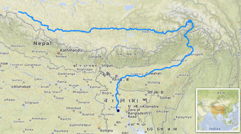
The Brahmaputra river embarks on an extensive journey spanning 2,900 kilometers, coursing through the territories of four nations: Tibet (China), Bhutan, India, and Bangladesh, before eventually flowing into the Bay of Bengal. As it reaches its culmination in the Bay of Bengal, it adopts the name Tamchok Khambab Kangri.
Throughout its course, numerous streams that are sourced from snowmelt converge into the river. These streams join the Brahmaputra from the mountain passes located approximately 60 kilometers southeast of Mansarovar Lake.

Brahmaputra River system begins at the pristine Himalayan Lake Manasarovar situated in Tibet. It embarks on its meandering course that ultimately culminates in the Bay of Bengal. As it commences its flow, the river initially heads eastward through the Tibetan landscape. Upon entering India, its direction shifts to the south and eventually transitions to a south-southwest trajectory. This remarkable river traverses a significant distance, covering approximately 2900 kilometers in total. The Brahmaputra River system covers distinct geographical regions. Out of the entire course, approximately 1,700 kilometers are situated within the expanse of Tibet, while India contributes around 900 kilometers to its flow. Finally, the river courses through Bangladesh for approximately 300 kilometers before reaching its final destination in the Bay of Bengal.
The three primary attributes of the Brahmaputra River: 1. Length and Basin 2. Hydrology and Floods 3. Biodiversity and Ecosystem
Millions of people in India and Bangladesh depend on the Brahmaputra River System for their livelihoods. Similar to the Ganga river, it holds significance for activities such as irrigation and transportation for the local populations.
The Brahmaputra in Tibet covers 293,000 square kilometers. The region's soil contains abundant iron, resulting in the river's distinctive red hue due to the prevalence of red and yellow soil sediments. This characteristic has led to the Brahmaputra River being commonly referred to as the Red River.
<div class="new-fform">
</div>